
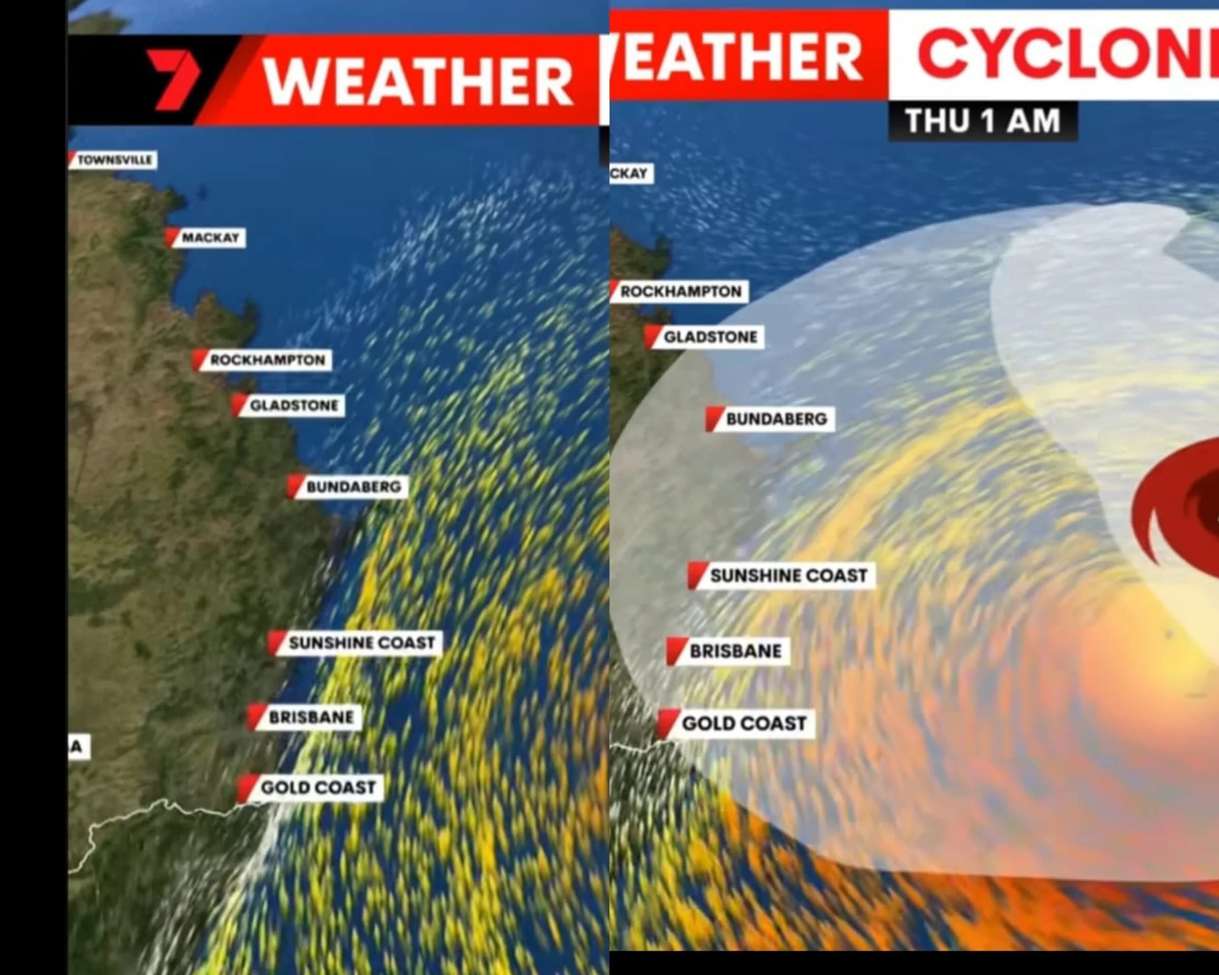
As Cyclone Alfred continues to develop in the Coral Sea, discussions regarding its potential impact on Southeast Queensland are intensifying. While the situation remains fluid and subject to change, current forecasts indicate that the region could face significant weather conditions by mid to late next week. This article provides an accurate, up-to-date overview of the storm’s predicted path and the uncertainties surrounding its impact. Over the next 24 hours, Cyclone Alfred is expected to shift southeast, potentially moving away from the Queensland coastline by Sunday. While this remains the
As Cyclone Alfred continues to develop in the Coral Sea, discussions regarding its potential impact on Southeast Queensland are intensifying. While the situation remains fluid and subject to change, current forecasts indicate that the region could face significant weather conditions by mid to late next week. This article provides an accurate, up-to-date overview of the storm’s predicted path and the uncertainties surrounding its impact. Over the next 24 hours, Cyclone Alfred is expected to shift southeast, potentially moving away from the Queensland coastline by Sunday. While this remains the most likely scenario, it is important to remain cautious, as any deviation in its path could significantly alter the situation. Cyclone movement can be unpredictable, and a closer approach to the coast later in the week remains a possibility. Regardless of the cyclone’s exact trajectory, Alfred is expected to generate exceptionally large swells along the Southeast Queensland coastline throughout next week. These waves are forecasted to be among the largest seen in recent years, creating serious risks for swimmers, surfers, and coastal infrastructure. Authorities have urged residents and visitors to exercise caution around the water, as dangerous conditions are likely to persist. The Bureau of Meteorology has issued warnings highlighting the uncertainty surrounding the storm’s potential path. While initial forecasts indicate a move away from the coast, there is still a chance that Alfred could shift closer to Southeast Queensland. This uncertainty has led to the Bureau issuing regular track updates through their app, urging the public to stay informed of any changes to the forecast. Despite the forecast models beginning to converge on a potential coastal crossing between mid and late next week, several risks remain. In the coming days, it is possible that Cyclone Alfred could move inland, affecting southern Queensland with damaging winds, heavy rainfall, and storm surges. However, this scenario is far from guaranteed and remains subject to change as further data becomes available. The track of the cyclone will continue to be monitored closely, and adjustments to the forecast will be made as needed. Cyclones are notoriously difficult to predict, and even small changes in Alfred’s trajectory could lead to vastly different outcomes. The storm’s behavior is complex, and shifting weather patterns could mean a range of possible impacts for Southeast Queensland, from minimal disruption to severe conditions. Continued monitoring over the next few days will provide more clarity on the cyclone’s behavior and potential risks. With the situation still developing, it is important for Southeast Queensland residents to take the following actions: Regularly check for updates from the Bureau of Meteorology, which provides the latest forecasts and warnings. You can access the 5-day forecast maps through MetEye on the Bureau’s website. Exercise caution along the coast, especially in areas known to be vulnerable to high surf and potential flooding. The large swells expected next week pose significant risks to coastal areas, and extra precautions should be taken. Review your emergency plans in case the cyclone shifts closer to the mainland. Be prepared for the possibility of strong winds, heavy rain, and power outages. While the long-term trajectory of Cyclone Alfred remains uncertain, it is crucial for residents of Southeast Queensland to remain vigilant and informed. By staying up to date with official forecasts and making necessary preparations, the community can ensure they are ready to respond to any potential impacts. As more information becomes available, the picture will become clearer, but for now, it is essential to prioritize safety and avoid speculation. Continue monitoring updates from the Bureau of Meteorology and take the necessary steps to protect yourself, your family, and your property.
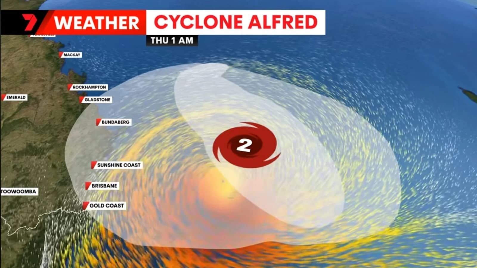
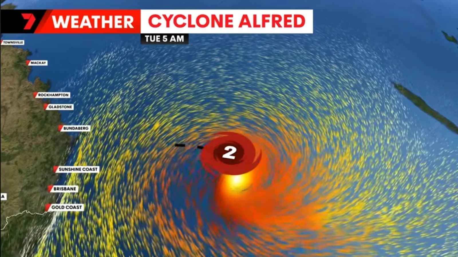
Source: the Bureau of Meteorology (BoM)



Comments
No comments yet. Be the first to share a thought.